As part of the Thy Kingdom Come Pentecost event in 2017 we created these pilgrimage routes that cover the whole of the diocese, four routes forming the shape of a cross.
Feel free to use or adapt these routes. Some of the routes are long enough to take a few days. All the routes follow National or Regional and District Walks which should be clearly marked.
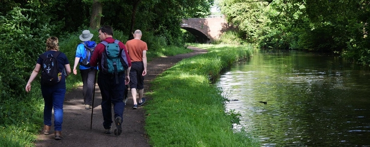
Route map
The Google map below includes the four routes, with stops marked along the way. Zoom in to explore the routes or view full screen. These routes have been mapped out as accurately as possible, but it is highly recommended you carry a map with you.
The four routes makes a cross shape the length and the breadth of the Diocese, but if it does not cross your parish why not choose a route of your own to join up, or try walking in a completely different part of the diocese?
The suggested routes are:
- FROM THE NORTH. Starting at Wall Heath, following the Staffs & Worcs canal to Stourbridge Canal on the Monarchs Way, then east into Dudley and Blakedown. Chaddesley Corbett, Hampton Lovell, Droitwich , Fernhill Heath and into Worcester on the Canal. Distance 36 mile 2-4 days. Part of Cycle path 45.
- FROM THE EAST on the Wychavon Way and Millennium Way. Starting at Church Lench on Wychavon joining Millennium at Flyford Flavell, The path veers off south near Mucknell via Spetchely Park into Worcester. 13 miles 1-2 days. Alternative route from Holberrow Green & Inkberrow on the Monarchs Way to join at Flyford Flavell.
- FROM THE WEST on the Three Choirs Way, beginning at Knightwick and appraching Worcester through Dines Green. Distance 10 miles 1-2 days.
- FROM THE SOUTH following the Severn Way along the river taking in Upton, Severn Stoke, Kempsey. Distance 15 miles 1-2 days. There is a good cycle route 45 /445 as an alternative.
Suggested shorter routes
Those of you who would like to take part but would prefer a shorter pilgrimage, there are four points marked in purple on the map. They are St Michaels Church Dines Green from the west; Brum Recreation Ground Fernhill Heath from the north; Nunnery Wood Country Park (County Hall) from the east; and viewing point at the Ketch from the South.
Toolkit
- Maps 1;50,00 No 139 Birmingham & Worlverhampton or 1:25,000 219,&204
- Maps 1;50,000 no 150 Worcester & The Malverns or 1:25,000 204 & 14 (NB if you buy these new you can download onto mobile using code provided in purchase.
- OR Down load Diocesan map which includes churches and other interesting features on routes
- Mobile phone charged
- Basic first aid kit, plasters, antihistamine,sunblock
- Water & snacks/lunch
- Rain wear and sunhat
- Walking boots/ shoes
- Walking pole
- Money
- If taking a dog, lead & poo bags. Water. (NB Dogs must be on leads in fields with sheep, but if you find yourself in a field with frisky cattle, it is best to let you dog off the lead! It will get away itself, whilst you get out as quick as possible.)
May the road rise to meet you, may the wind be ever at your back, may the sun shine warm upon your face, and the rain fall soft upon your fields.
Remember the Country Code. Leave nothing but footprints. Take nothing but photographs.